33B WESTVALE MEADOW
Owner Information
COLLINS J STEPHEN
33B WESTVALE MDWS
CONCORD, MA 01742


Property Details
33B WESTVALE MEADOW is classified as a AFFORDABLE MDL-05 (Condominium).
The primary structure on this property was built in 1990. There are 1,609ft2 of built area within this property. There is 1,192ft2 of residential/living space within this property. This property is listed as having 4 rooms.
33B WESTVALE MEADOW is valued at $482,600. The land is valued at $0 and the structures are valued at $482,600.
This property is in Zone C. Confirm with local Zoning Board authorities to ensure there are no overlays or other easements on this property.
The most recent deed for 33B WESTVALE MEADOW is recorded at the local registrar in Book 44480, Page 0185. 33B WESTVALE MEADOW was last sold on Friday, January 14, 2005 for $365,000.
Assessment data from fiscal year 2022.
Flood Data
This property is partially within the AE Zone (within floodplain). Approximately 5.25 acres (72.2%) of the property is within this zone.
A portion of this property is denoted as being within a floodway.
This information is sourced from the FEMA National Flood Hazard Layer. See our full disclamer.
Broadband Internet Providers
| Provider | Type | Bandwidth (mbps) | |
|---|---|---|---|
| HughesNet | Satellite | 25 | 3 |
| Comcast | Cable | 1000 | 35 |
| Verizon New England Inc. | DSL | 5 | 0 |
| Concord Light Broadband | Fiber | 300 | 300 |
| GCI Communication Corp. | Satellite | 0 | 0 |
| Viasat Inc | Satellite | 100 | 3 |
| VSAT Systems, LLC. | Satellite | 2 | 1 |
Broadband service provider data from December 2020.
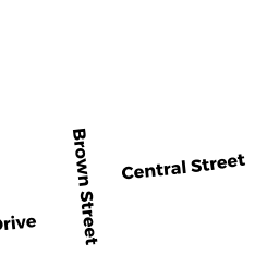
Adjacent Properties
- 1667 MAIN ST
Single Family Residential owned by ERMARTH, JAMES E - 1681 MAIN ST
Two-Family with Commercial owned by ALEXANDER HEDY A TR - 1687 MAIN ST
Two-Family Residential owned by EMFIELD, ADAM G - 171A MAIN ST
RES COMMON owned by WESTVALE MEADOWS INC - 14 MILLRUN LN
Residential Condominium owned by NOW CONCORD MAIN LLC - 16 MILLRUN LN
Residential Condominium owned by NOW CONCORD MAIN LLC - 18 MILLRUN LN
Residential Condominium owned by NOW CONCORD MAIN LLC - 20 MILLRUN LN
Residential Condominium owned by NOW CONCORD MAIN LLC - 27 MILLRUN LN
Residential Condominium owned by FREEDMAN, DAVID A - 30 MILLRUN LN
Residential Condominium owned by PIERSON TR, DAVID R - 35 MILLRUN LN
Residential Condominium owned by KEMPERMAN, BRUCE - 36 MILLRUN LN
Residential Condominium owned by THAYER, PHILIP K - 38 MILLRUN LN
Residential Condominium owned by RUGGIERO TR, GARY J - 40 MILLRUN LN
Residential Condominium owned by EDWARDS, ALIZA W - 41 MILLRUN LN
Residential Condominium owned by GRIFFITH TR, STANLEY - 45 MILLRUN LN
Residential Condominium owned by VEAGUE, JOHN R - 8-45 MILLRUN LN
Other, Open Space owned by None - 8 MILLRUN LN
Residential Condominium owned by NOW CONCORD MAIN LLC - 12 MILLRUN LN
Residential Condominium owned by NOW CONCORD MAIN LLC